DisTUrbE - Dispersion in the Turbulent Urban Environment
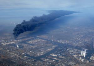
Air pollution levels in urban environments become increasingly problematic with rising energy consumption and urbanization. Effective measures to control air quality depend on reliable predictions of pollution concentration levels in the urban boundary layers. While mean concentrations can be predicted with reasonable accuracy for some simple cases, hazardous situations require prediction of peak concentrations. These depend on the details of the instantaneous turbulent flow, which are not appropriately captured in current dispersion models. Also, model studies mainly address average conditions, whereas air pollution becomes a direct threat to public health under extreme weather conditions and in the case of sudden localized releases, such as accidents, natural disasters and acts of terrorism.
The main challenge is to obtain a proper description of pollution at intermediate scales (10-1000 m), where the complexity of the flow is determined by typical urban scales (streets, neighborhoods). Dispersion at larger scales (1-10 km) is currently reasonably well described by conventional plume models. The development of adequate models of these challenging intermediate scales and surface topology will make it possible to determine the effects of measures and regulations for air quality control. Obtaining such a reliable method is of the highest importance to a densely populated country, such as The Netherlands, where the urban areas are in close proximity to heavy traffic routes and industrial areas. This is why we choose this geometry as the principal focus of this proposal. A reliable model is needed for these cases to ensure the quality of life and fulfill the governmental responsibility to the public. Yet, these issues are not exclusive to the Dutch case, but they occur worldwide.
Given that operational dispersion models need to be quantitatively accurate and reliable, it is of importance that these models are properly validated. This is achieved in this proposal by utilizing modern simulation methods, such as Direct Numerical Simulations (DNS) and Large-Eddy Simulations (LES). These simulations do not suffer from shortcomings found in models for Computational Fluid Dynamics codes (CFD, RANS). Our numerical results will be validated against experimental data, utilizing field measurements and detailed data acquired in laboratory scale models using state-of-the-art experimental methods, such as tomographic Particle Image Velocimetry (PIV) and Laser Induced Fluorescence (LIF), which comprises a significant part of the research. From the numerical and experimental data we will distill low-order representations that describe the effect on the turbulent motions on the pollution dispersion.
We focus on a number of relevant basic geometries, including a major road adjacent to urbanization. (This case is frequently encountered in The Netherlands.) The effectiveness of sound barriers and other measures is investigated in relation to the dispersion of pollution at scales typical of urban areas.
The results of this research will be utilized in case studies carried out in close collaboration with users that are part of the project consortium, including consultancy companies (FlowMotion, KEMA, CERC), technology institutes (TNO, ECN) and governmental agencies (RWS, City of Rotterdam).
We envision that this research will lead to a significant improvement of the quantitative prediction capability of pollution dispersion models, validated under various conditions, which serve to improve the assessment of air quality in urban areas.
This project is funded through STW (http://www.stw.nl)

Chair:
Fluid Mechanics
Involved People:
Dr.ir. Gerrit E. Elsinga
Dr.ir. M.J.B.M. Pourquie
ir. Jasper Tomas
Ir. Jerke Eisma
Manu Goudar Vishwanathappa
prof. J.C.R. Hunt
Prof.dr.ir. J. Westerweel
Facilities used:
low-turbulence wind tunnel
Water tunnel for Optical Diagnostics Applications (WODA)