
A river in the foothills of the Himalayas separates tigers and farmers and nurtures both wildlife and agriculture. But now that the river is drying up, conflicts between the two are increasing, endangering the habitat of both. River scientist Kshitiz Gautam is looking for ways to restore the balance between man and nature.
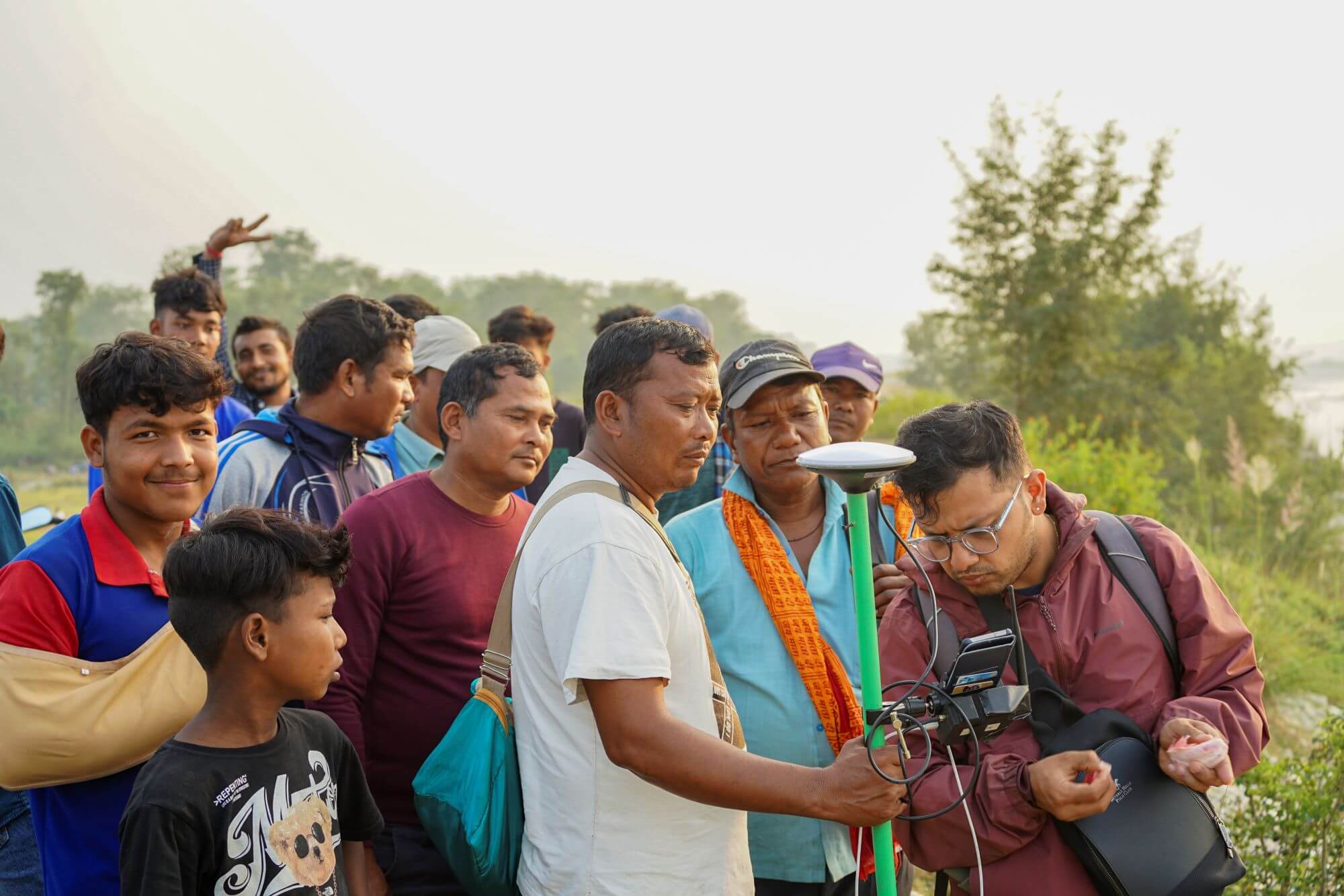
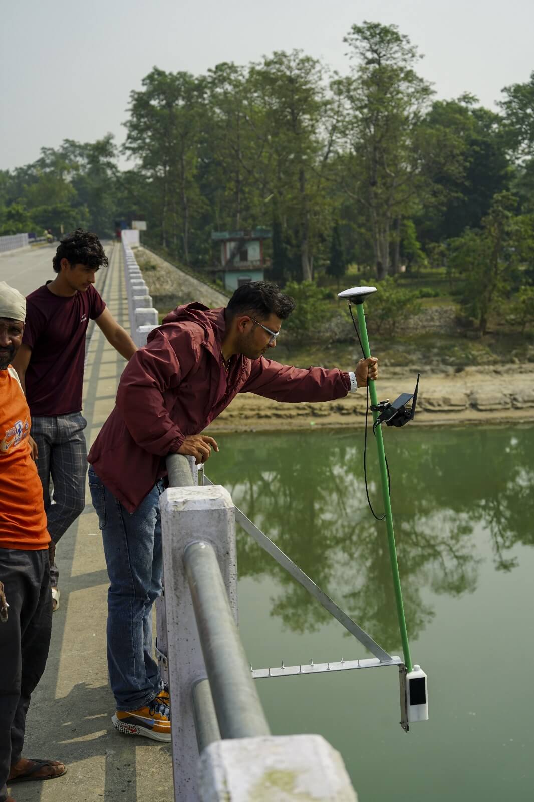
For weeks, PhD-candidate Kshitiz Gautam steered his motorbike over the stony surface along the clear blue waters of the Karnali River in Nepal. Armed with a bright green digital measuring rod he was scouring walls, trees and stones for signs of earlier water level markings left there by the floods.
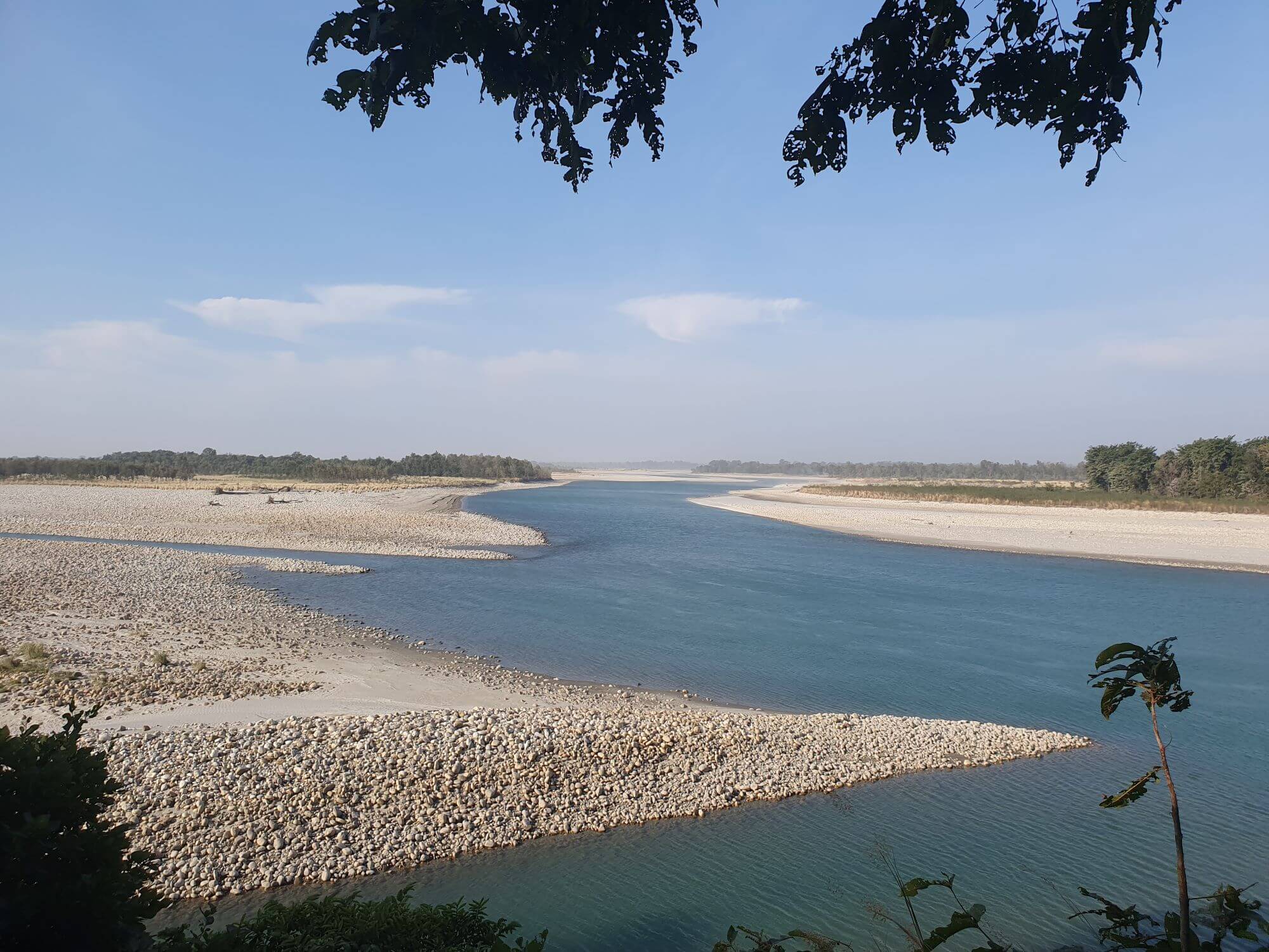
The Karnali River splits in two branches, one of them dividing a national park from the farm lands. Gautam collects data about the river to understand why this particular river inlet is drying out while another, outside the park, is expanding. The falling water level is posing a serious threat to the local population and animals alike. Gautam’s research is part of a project called ‘Save the tiger, the grasslands, the water’.
Dissolving barrier
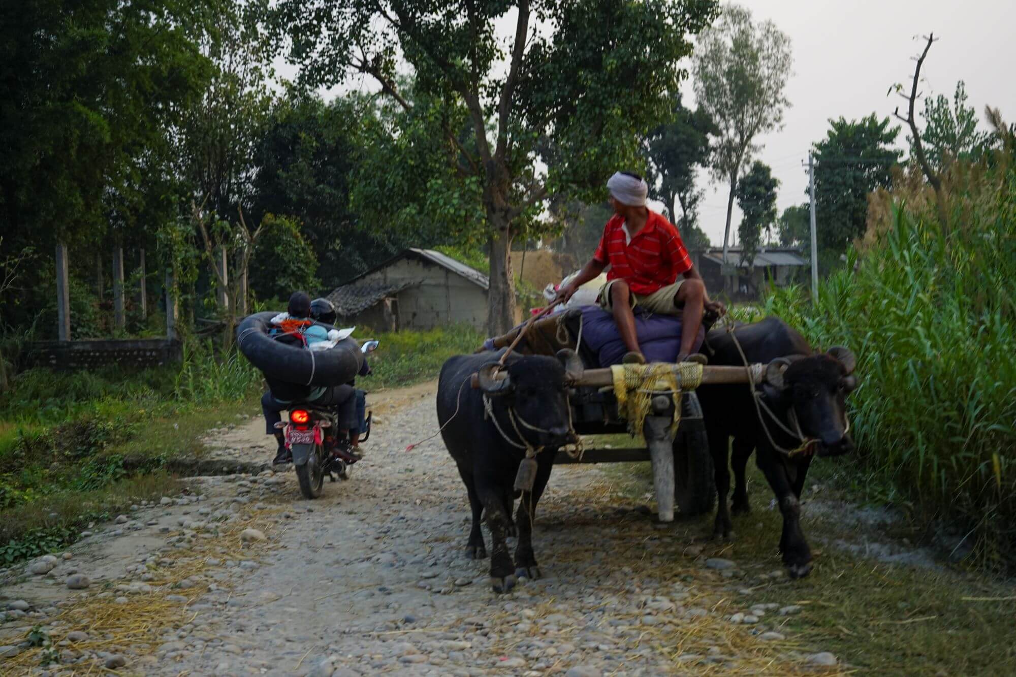
The riverbank soil is packed with nutrients and is particularly suitable for growing crops. During the dry season, the water is so low that tigers can easily make their way across from the national park towards the crop fields. Confrontations with tigers are becoming a growing concern, as Gautam himself witnessed.
“I had a close encounter with one when I was doing fieldwork in 2022. I was going about my business when suddenly people started shouting. A tiger had attacked a cow and killed it not far from where I was standing,” he said. The tigers are not just targeting cows, attacks on people are also becoming more common.
Save the tiger, and deer, and grass
The river also plays an important role in nature conservation. It carries nutrients from the Himalayas which boost grass growth along its banks. The grasses are eaten by deer, which in turn feature on the tigers’ menu. Without the river to sustain it, the food chain is in danger of collapsing. There are some 4,000 tigers left in the world, and Bardiya National Park in Nepal is one of their most important habitats.
The river in numbers
To find out what makes the water level drop Gautam is devising a computer model of the river. He uses the model to investigate possible causes, such as huge boulders transported from the Himalayas blocking the flow, climate change and human intervention. “At the nearby Koshi River, for instance, we found that dams for hydroelectric power stations are blocking sediment transport and that means habitat downstream is being deprived of important nutrients,” Gautam says.
The research is first and foremost practical, Gautam said. “I am not doing fundamental research. This is about practical solutions for the local population to work with.” Gautam was able to advise the local park rangers, for example. “They wanted to dredge the drying inlet to one meter, but this would not have been enough. With my data I could advise them how much dredging was necessary so water would flow again in the branch.”
With my data I could advise them how much dredging was necessary so water would flow again in the branch.
Home game
To create his model, Gautam needed data on water levels and sediment types. As historical records were unavailable, Gautam turned to the river itself to get the information.
This wasn’t Gautam’s first time in Nepal. He grew up not fifty kilometres from the river. “That PhD vacancy felt tailor-made for me!”, he laughs. Apart from knowledge about the area, Gautam also had the requisite academic credentials. He did his master's in Hydroinformatics and studied the effect of river morphology on ecology. “Human interventions, such as hydroelectric power stations, must co-exist with nature with the least disturbance to the natural balance.” That is what Gautam tries to achieve at the Nepalese river.
On his return to Nepal, Gautam found the river had changed considerably. “Years ago we used a ferry to get across but now you can just wade through.”
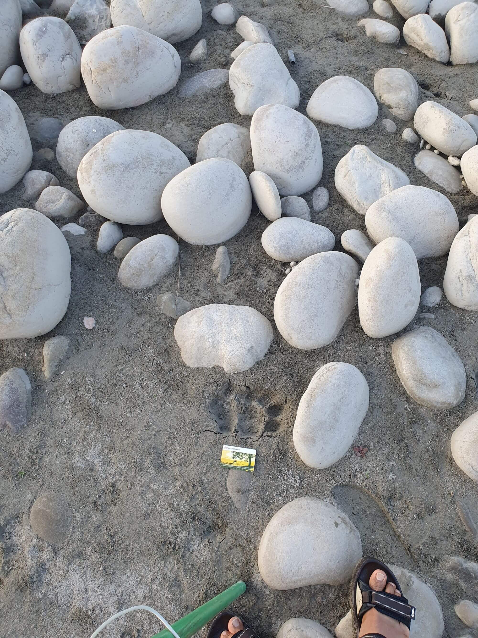
Sediment sampling using an OV chip card
While preparing for the research from his desk in the Netherlands, Gautam had decided he would take depth measurements and river sediment samples every five kilometres. However, the big boulders made sampling the river bed a challenge. Photographs proved to be the solution but how to estimate the size of the boulders from the pictures? A quick rummage through his pockets produced the perfect measuring tool. “I used my OV chip card for scale!” Gautam said.
Convincing the locals
The reception of the GPS signal was not as straightforward as it had seemed either. To precisely measure the water level marking, the GPS on top of the green rod requires strong communication signal with the antenna which needed a high vantage point. The bridge over the river turned out to be too low. “The tallest place we could find was a four-storey house”, Gautam set out to persuade the owners to let him place his antenna on the roof. “In Nepal, the best way to get this done is first making a friendly relationship. If you gain trust first, it makes it easier request,” he said. Gautam visited the family a few times and, in the end, permission was granted.
Proud
Gautam’s knowledge of the Nepalese language, nature and culture proved to be invaluable during his fieldwork. “Studying and working in Nepal, I learned to use limited resources and equipment that are at hand. This in combination with measuring equipment at TU Delft made the fieldwork a success.” And now, the installed radar water level sensor allows him to gauge the local water distribution from his desk in the Netherlands as it happens. “I’m proud to have this knowledge and can use it to help my community and make it better,” Gautam said.


