If you travel far enough north, sooner or later, you will reach the polar circle. A sign sometimes announces your arrival, like in the Finnish city of Rovaniemi, but you’re probably not always aware of crossing such an imaginary line. Everyone has heard of other geodetic latitudes like the equator and the tropics, but did you know there is also one running straight across campus: the 52nd degree of latitude?
When Professor Ramon Hanssen realised this years ago, he came up with the idea of making it visible. After all, results in his professional field of geodesy – which, for Hanssen, involves plenty of earth observation – are often not as tangible. In November 2011, Hanssen and some companions furtively sprayed the line on the pavement. He pitched the idea for a proper design to the Executive Board and the Deans of the faculties of Civil Engineering and Geosciences and Industrial Design Engineering.
52° North made visible
The funny thing about this degree of latitude, says Hanssen, is that it has a time effect. This is because the Eurasian continent is moving towards the northeast. “So you see the line ‘drop’. The line used to be elsewhere, which means we can make the factor of time visible on campus. Calculations have revealed that the continent moves 16 millimetres northwards every year.”
Hanssen’s plan remained dormant for a while, but now – seven years, or 11.2 cm later – the line is a fact. It runs between the glass part of the building of the Faculty of Civil Engineering & Geosciences and the faculty of ME.
At the centre of the blue line is a white band containing a 16-millimetre-wide black line, which indicates the position of the 52nd degree of latitude on 1 January 2018. For anyone thinking of measuring it: it is already no longer in the same position. ‘The width of the black line represents the shift per year’, explains Hanssen.
Time effect
To illustrate this time effect, six grey lines have been painted parallel to the blue line. These grey lines indicate significant events related to Delft events. The first line is 2.79 metres to the north, and marks the foundation of TU Delft in 1842. The following three lines represent events in the Golden Age:
- The first time that Delft researcher Antoni van Leeuwenhoek described bacteria, in 1676. This line is 5.4 metres to the north of the 2018 position.
- The escape of Delft-born Hugo Grotius from Loevestein Castle in a book chest in 1621. This line is 6.3 metres more northerly than the 2018 line.
- The murder of Willem of Orange in Delft in 1584; 6.9 metres to the north of the 2018 line.
The fifth line is 12 metres from the blue line: this was the position of the 52nd degree of latitude in 1246, when Delft was enfranchised.
The final line, at a distance of 32 metres, indicates the start of the Western calendar era: the year 1.
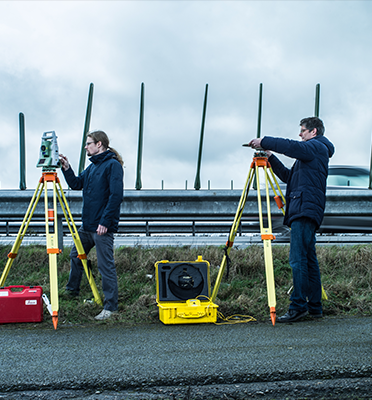
Explanatory signs will be installed soon. Hanssen will present a film about the project at the official opening of the line, for which a few recordings were made yesterday. He asked Mark Bemelmans and Rianne Broeksma, his Geoscience and Remote Sensing Master’s students, to run a temporary blue line over Professor Van der Hagen’s desk. You see, the imaginary line runs directly across his conference table.
Bemelmans subsequently walked into the pond next to the Executive Board, the water coming right up to his middle, to show how the line would proceed from the reeds on the waterside.
What now? Hanssen says that some new ideas are being thrown around, such as continuing the line in the carpet. Or even over the roof, to make it visible on Google Maps. Another idea is for students to be able to write their name next to the line when they graduate, inspired by the ‘Sweat Room’ at Leiden University. ‘The idea is that if you now start studying here and complete your course within the nominal study period – so, a three-year Bachelor’s and two-year Master’s – the line will have moved 5 x 16 millimetres = 8 centimetres’, says Hanssen.
This story was previously published in Delta. Photos and text by Connie van Uffelen.


