Did Mesdag ‘forget’ to paint part of Scheveningen?
When he painted his Panorama in 1881, Hendrik Willem Mesdag seems to have forgotten part of Scheveningen. This was the finding of measurements carried out by TU Delft students on the occasion of the exhibition ‘From the highest point: land surveying in Mesdag’s day’ (Dutch), which opens at Panorama Mesdag on 31 March.
The exact position
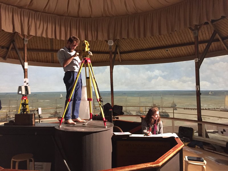
In his Panorama, Mesdag attempted to depict the view of Scheveningen from the Seinpostduin as precisely as possible, and he did well, but it was already known that something wasn’t quite right. In order to find out more, the students carried out surveying measurements in the Panorama as though they were the actual measurements in the dunes in 1881. Eleven prominent landmarks could be identified in the Panorama that still exist today, almost 140 years later, including lighthouses, churches, and several other tall buildings. Four of these landmarks form part of the National Triangulation Network, meaning we know their exact position. The position of the other seven points could be determined accurately using topographical maps.
Stepping back in time
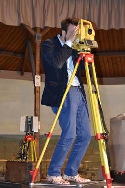
By using a modern theodolite (angle-measuring instrument) to measure the directions to all eleven points in the painting, the students could step back in time, as it were, to the exact spot where Mesdag had stood when he painted his famous Panorama. By means of a so-called ‘position resection’, the measurements were then used to calculate Mesdag’s position in the National Triangulation Network. To do this, students used computer calculations that are also used in geodesy nowadays.
The hunt
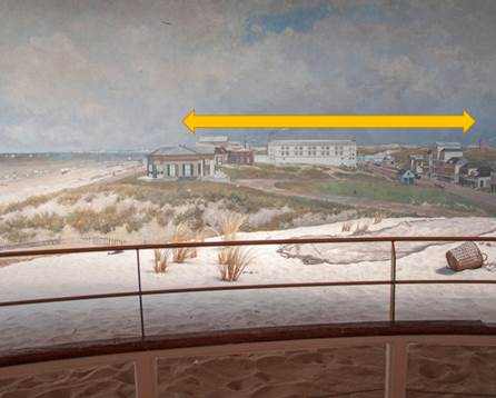
The calculations revealed that it was impossible to determine Mesdag’s position and a hunt began to find out how this could be the case. Had the students made a measurement error, were the coordinates of the points incorrect, or had the mistake already been made in 1881? Having worked through all the possibilities, it turned out that Mesdag seems to have ‘forgotten’ a 10-degree section, corresponding to a 3-metre-wide section in the painting. As the painting is round, however, this automatically means that the ‘extra’ 3 metres had been added elsewhere, where the painting had been stretched, as it were.
The ‘stretched’ part lies in the northeast of Scheveningen, roughly in the direction of Gevers Deynootweg. The most likely reason is that Mesdag shifted several buildings around slightly, or made small adjustments to their dimensions. Thankfully, we need not be so concerned about the ‘forgotten’ section: it turns out that the forgotten 3 metres lie in the North Sea.
Determining Mesdag’s position
Once the corrections had been incorporated, Mesdag’s painting position could finally be determined as 52.109623 degrees north latitude and 4.275900 degrees east longitude. In the National Triangulation Network, this has the coordinates (78.873,35; 458.514,87). At the site itself, the students marked the location on the pavement.
TU Delft Library collection on display
The background to this ‘survey of the past’ is the partnership between Panorama Mesdag and TU Delft on the exhibition ‘From the highest point’. This exhibition is a unique occasion for TU Delft Library to display its Special Collections beyond the confines of the campus. In the exhibition halls of Panorama Mesdag, the history of surveying is literally mapped out using surveying instruments, drawings and historical maps, and the exhibition is based on the question: ‘what are the similarities and differences between the artistic and the scientific approach?’
More information
The exhibition ‘From the highest point: land surveying in Mesdag’s day’ will be on display at Panorama Mesdag between 31 March and 22 September 2019. Panorama Mesdag, Zeestraat 65, 2518 AA The Hague, www.panorama-mesdag.nl
From 11:00 on Thursday 28 March, the press opening will be held of the new exhibition ‘From the highest point: land surveying in Mesdag’s day’. The invitation is enclosed as an appendix, along with Panorama Mesdag’s press release on the exhibition. The press opening will include a talk on the research by Prof. Ramon Hanssen, who supervised the TU Delft students.
Contact Ramon Hanssen
TU Delft Science Communication Adviser Roy Meijer, r.e.t.meijer@tudelft.nl, +31 (0)15 278 1751
Contact Panorama Mesdag Caroline Rijks, +31 (0)70 752 1481, media@panorama-mesdag.nl
Land surveying at Panorama Mesdag
This map shows the result of angle measurements taken in the Panorama to determine Mesdag’s position. The research was carried out by students and researchers at TU Delft.


