
Prof.dr.ir. N.C. van de Giesen
Prof.dr.ir. N.C. van de Giesen
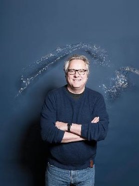
Since July 2004, Nick van de Giesen has held the Van Kuffeler Chair of Water Resources Management of the Faculty of Civil Engineering and Geosciences. He teaches Integrated Water Resources Management (CIE4450) and Water Management (CTB2120). His main interests are measuring and modeling of complex water resources systems and the development of science-based decision support systems. Development of new observation techniques, both in situ and through satellites, as well as High Performance Computing, are the core themes of both research portfolio and teaching curriculum. Since 1 January 2015, he is chairman of the Delft Global Initiative.
Before coming to Delft University, he worked from 1998 to 2004, at the Center for Development Research of Bonn University, with as main activity the scientific coordination of the GLOWA Volta Project. From 1994 to 1998, he did Post-Doctoral research on the hydrology and management of inland valleys at WARDA, Cote d’Ivoire. He received his Ph.D. from Cornell University for his work on wetland development in Rwanda. At Wageningen University, he did his M.Sc. in irrigation engineering. For a complete CV see CV_Nick_van_de_Giesen.pdf.
Expertise
Stories of Science
Main research projects
Trans-African Hydro-Meteorological Observatory (TAHMO)
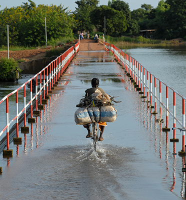
Monitoring Africa's environment is an important challenge if the continent's resources are to be used in an optimal and sustainable manner. Food production and harvest predictions would profit from improved understanding of water availability over space and time. Presently, the African observation network is very limited. National governments and regional planners do not have the data to make proper decisions regarding investments in water resources infrastructure.
The idea behind this project is to build a dense network of hydro-meteorological monitoring stations in sub-Saharan Africa; one every 30 km. This asks for 20,000 of such stations. By applying innovative sensors and ICT, each station should be very cost efficient in installation, operation, and maintenance. The stations are placed at schools and integrated in the educational program. The data will be combined with models and satellite observations to obtain a very complete insight in the distribution of water and energy stocks and fluxes.
Within this project, we continue to build and test new sensors, such as an acoustic disdrometer (rain gauge) that can be produced for a fraction of the costs of a commercial equivalent with the same specifications. The first prototype disdrometer was developed in The Netherlands and tested in Tanzania for a total project cost of €5000. A recent addition is the use of GPS (GNSS) receivers for measuring atmospheric water content. This idea won the 2015 Academic and Regional European Satellite Navigation Challenge. See: tahmo.org.
eWaterCycle
This project will develop a high-resolution global hydrological model. The project is a cooperative effort by Utrecht University, the Netherlands eScience Center, and TU Delft. This model was developed in Utrecht and is called PCRGLOB-WB. The model has been parallelised in order for it to be run very fast on a CPU cluster or a super computer. The final ambition is to run the model at a grid of 100m x 100m, with as first intermediary step a global grid of 10km x 10km. The model will be assimilated with measurements collected on the ground and by satellites. Because the main computational bottle neck for this development is the memorry directly accessible by the CPU's, a special data assimilation algorithm has been developed in order to keep model development scalable. A beta version of the model can be found at forecast.ewatercycle.org. The video presents the project.
Distributed Temperature Sensing
An important focus of recent research concerns the application of Distributed Temperature sensing (DTS) to water management problems. DTS allows for precise measurement of temperature along a fiber optic cable. The length of the cable may go up to 10 km and temperature will be measured at each meter. Accuracy will increase with the duration of the measurement. For measurements of 30 seconds, an accuracy of 0.1 K can be obtained, improving to 0.02 K for measurements of 30 minutes.
The applications have been numerous, leading to many scientific publications in recent years (see below). The first application concerned groundwater inflow into a small stream in Luxembourg. Subsequent applications include finding illicit sewer connections, finding seepage zones in canals, determining soil moisture content, and determining atmospheric temperature profiles. Important partners are Oregon State University, University of Nevada Reno, Ecole Polytechnique Fédérale de Lausanne, and Charles Sturt University. Regular workshops are organized to help scientists become familiar with this interesting technique (see ctemps.org).
For a list of all projects which are conducted in Nick van de Giesen's chair see all projects.
Publications
-
2024
On the importance of discharge observation uncertainty when interpreting hydrological model performance
Jerom P. M. Aerts / Jannis M. Hoch / Gemma Coxon / Nick C. van de Giesen / Rolf W. Hut
-
2024
On the importance of plant phenology in the evaporative process of a semi-arid woodland
could it be why satellite-based evaporation estimates in the miombo differ?
Henry M. Zimba / Miriam Coenders-Gerrits / Kawawa E. Banda / Petra Hulsman / Nick van de Giesen / Imasiku A. Nyambe / Hubert H. G. Savenije -
2024
Safe Sowing Windows for Smallholder Farmers in West Africa in the Context of Climate Variability
Sehouevi Mawuton David Agoungbome / Marie-claire ten Veldhuis / Nick van de Giesen
-
2023
A Bayesian model for quantifying errors in citizen science data
application to rainfall observations from Nepal
Jessica A. Eisma / Gerrit Schoups / Jeffrey C. Davids / Nick van de Giesen -
2023
A stochastic MPC framework for the control of pumping stations in polder systems with regard for uncertainty in inflow and hourly electricity prices
Ties van der Heijden / Nick van de Giesen / Peter Palensky / Edo Abraham
-
Prizes
-
2023-9-13 The Ambassador Award is given annually to between one and five honorees in recognition of their outstanding contributions to one or more of the following areas: societal impact, service to the Earth and space community, scientific leadership, and promotion of talent/career pool. The Ambassador Award honors individuals whose achievements extend beyond those recognized by traditional scientific discipline awards.
Read article AGU Ambassador Award
-
2015-10-20 Prof Dr Nick van de Giesen, Dr Eugenio Realini :: University Challenge
Read article Special Prize Winner at the 2015 European Satellite Navigation Competition
GNSS Monitoring of Precipitable Water Vapour over East Africa Using Low-Cost Receivers
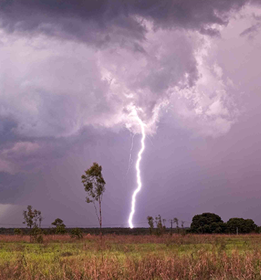
African weather is poorly monitored, especially for forecast purposes. At the same time, African societies are vulnerable to extreme weather events. By far the most critical weather variable is rainfall. To make good predictions about rainfall, it is important to know how much water vapour the atmosphere contains. More water in the atmosphere means more rainfall. Traditionally, this amount of water is measured by weather balloons, but these are expensive and there are only few regular launches over Africa. GNSS signals travel slightly more slowly through moist air than through dry air. A GNSS receiver can measure the extra delay caused by moisture in the atmosphere, even though the differences are very small. Today, even low-cost GNSS receivers are so accurate that they can measure these delays. The plan is to add these low-cost GNSS receivers to the stations of the TAHMO (Trans-African Hydro-Meteorological Observatory, www.tahmo.org) network around Lake Victoria. TAHMO is building a network of 20,000 robust and cost-efficient weather stations across Africa. By adding GNSS/Galileo receivers, it will be possible to greatly improve rainfall predictions.
The award ceremony took place during the Satellite Masters Conference. The ceremony was held at the ddb forum in Berlin Oct. 20. The awards ceremony was held in conjunction with the Copernicus Masters awards for Earth observation.
Satellite Masters Conference 2015 -
2015
Read article Henry Darcy Medal 2015
The 2015 Henry Darcy Medal is awarded to Nicolaas C. van de Giesen for his fundamental contributions to multidisciplinary research in water management for sustainable development -
2014 Best professor award TU Delft, given to one professor per year.
Read article Leermeester Prijs 2014
-
2010
Read article IBM faculty award 2010
IBM faculty award 2010
Media
-
2023-09-03
Nick van de Giesen in de media 2023
Appeared in: The Independent
-
2022-03-15
Nick van de Giesen in de media 2022
Appeared in: H2O
-
2021-09-24
Afrikaanse boeren hebben betere weersvoorspellingen nodig
Appeared in: Washington Post
-
2020-01-23
River deltas are changing shape
Appeared in: Cosmos Magazine
-
2020-01-17
Rekenen aan popcornbuien in Afrika
Appeared in: Nemo Kennislink
Ancillary activities
-
2023-09-19 - 2025-09-30
Other services
-
2022-09-01 - 2026-09-30
Other services
-
2022-04-01 - 2027-01-29
Consultancy / research and other
-
2024-09-22 - 2026-09-22
Other services
-
2024-09-22 - 2026-09-22
Other services
-
2024-09-26 - 2026-09-25
Other services


